本文已被:浏览 1675次 下载 4430次
投稿时间:2017-02-28 修订日期:2018-03-10
投稿时间:2017-02-28 修订日期:2018-03-10
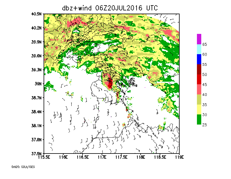
中文摘要: 受北上气旋影响,2016年7月20日京津冀地区出现了历史罕见的大暴雨,三地日平均降雨量均创50年来历史极值。利用风云二号F星(6 min时间间隔,水平分辨率5 km)和自动气象站的加密资料、雷达图像及拼图数据资料,结合NCEP 1°×1°再分析资料,采用叠加分析、TBB梯度计算、雷达低空风场反演等方法,分析了北方气旋类暴雨的云图特征和多尺度(包括天气尺度和α、β、γ中尺度)组织、热力、动力的结构配置;并且针对造成北京、天津城区短时强降水的两个MγCS,分析了影响它们发生发展的多尺度环境。结果表明:(1)逗点云系中不同部位的热力、动力及水汽配置是:涡旋中心(文中D区)与气旋环流中心重合而且是700 hPa假相当位温θse的低值区;在云系尾部云带(C区),低空急流带和θse高值区重合,云带西侧是干冷无云区,云带边缘的光滑地带对应着能量锋区;云系头部(A区和B区)与700 hPa θse高能区、850 hPa急流核对应(A区和B区分别对应东北气流和东南气流急流)。急流带内700 hPa的θse高达78℃,850 hPa的比湿最大值为18 g·kg-1,最大急流核风速达30 m·s-1,整层可降水量是70 mm。(2)逗点云系头部嵌着两个MαCS、一个MβCS,它们造成降雨的强度为20~30 mm·h-1;而两个MγCS的雨强却达40~70 mm·h-1。北京MγCS BJ和天津MγCS TJ发展维持的背景不同:(a)MγCS BJ位于涡旋中心——低空急流左前方的对流不稳定区内偏北风与东风形成的地面辐合线上,此辐合线的形成超前于对流系统约1.5 h。(b)MγCS TJ位于云头与涡旋中心之间边缘地带——θse高梯度的能量锋区中,东风风速形成的地面辐合线上。(3)MγCS TJ的发展与MβCS边缘TBB梯度大值区的关系密切,MγCS TJ内部具有深厚的中气旋(轴心随高度向西北倾斜),在旋转速度最强的时刻,其造成的雨强也最大。
Abstract:Affected by northward cyclone, a rarely seen severe rainstorm hit the Beijing Tianjin Hebei Region on 20 July 2016, resulting in a new extremum of daily mean precipitation amount in this region in the past 50 years. Using the FY 2F satellite data with 6 min interval and 5 km horizontal resolution, radar data and AWS (automatic weather station) data collected every 10 min, NCEP 1°×1° reanalysis data with 6 h interval as well as the methods of multiple data overlay analysis, TBB gradient computation, retrieval of radar low level wind etc., this paper analyzes the cloud image characteristics of cyclonic rainstorm cloud system in northern China and the organization, dynamic and thermodynamic structures of multi scale systems (synoptic scale and meso α, meso β, meso γ scale convective systems). Two meso γ scale convective systems (MγCSs), which contribute to the severe rainstorms in the urban areas of Beijing and Tianjin are taken as examples to analyze the relationship between multi scale ambient configuration and the severe torrential rain events. The results are as follows. (1) The thermodynamic and vapor configurations of different parts of the comma cloud system are: the vortex center (Zone D) coincides with the center of the cyclonic circulation and is a low value zone of the 700 hPa pseudo equivalent temperature (θse). The west side of the tail cloud zone is a dry, cold and cloudless zone. The smooth zone at the edge of the cloud zone corresponds to the energy front zone. The head of the cloud system (Zones A and B) corresponds to the θse high energy zone of the 700 hPa and the jet stream core of the 850 hPa, while the Zones A and B correspond to northeast and southeast jets, respectively. In the jet zone, the θse of 700 hPa is as high as 78℃, the 850 hPa specific humidity is 18 g·kg-1, the maximum jet core wind speed is 30 m·s-1, and the entire precipitable water amount is 70 mm. (2) The comma cloud system has two MαCSs and one MβCS embeded in the head, which are the major contributors to the severe torrential rains, but the rain intensity is only 20-30 mm·h-1. However the MγCS in Beijing (MγCS BJ) and MγCS in Tianjin (MγCS TJ) both caused extremely heavy precipitation with the intensity getting to 40-70 mm·h-1. The two MγCSs are generated and maintained under different multi scale background conditions: (a) MγCS BJ is located in the vortex center (Zone D), which is the left front convective instability zone of the low level jet, combined with the wind direction convergence line formed by the northerly wind and the east wind. The convergence line appears about 1.5 h earlier than the convective system. (b) MγCS TJ is located in the edge zone between the cloud head and the vortex center. It occurs in the high gradient energy frontal zone of θse and matches the surface wind speed convergence line. (3) The development of MγCS TJ is closely related to the large value zone of TBB gradient in the MβCS edge. MγCS TJ has a deep mesocyclone inside, with the axis tilting to northwest, and the maximum rain intensity occurs at the moment when the rotation speed is the fastest.
文章编号: 中图分类号: 文献标志码:
基金项目:国家自然科学基金面上项目(41475050和41575049)及天津市气象局“气象预报预警创新团队”培育经费共同资助
| 作者 | 单位 |
| 易笑园 | 天津市气象台,天津 300074 |
| 陈宏 | 天津市气象台,天津 300074 |
| 孙晓磊 | 天津市气象台,天津 300074 |
| 王艳春 | 天津市气象台,天津 300074 |
| 韩婷婷 | 天津市气象台,天津 300074 |
| 李云 | 国家卫星气象中心,北京 100081 |
引用文本:
易笑园,陈宏,孙晓磊,王艳春,韩婷婷,李云,2018.“7·20”气旋大暴雨中多尺度配置与MγCS发展的关系[J].气象,44(7):869-881.
YI Xiaoyuan,CHEN Hong,SUN Xiaolei,WANG Yanchun,HAN Tingting,LI Yun,2018.Multi Scale Configuration of the 20 July 2016 Cyclone Induced Severe Torrential Rain and Its Relationship with the Development of MγCS[J].Meteor Mon,44(7):869-881.


